DOWN EDEN
Cumbria is not the Lake District. It should go without saying, but it doesn’t, because in the minds of many, the two are synonymous. If Cumbria makes sense at all – as a place, as a unit, as a human delineation – then it does so because of its natural borders; the hemispheric sweep of the Irish Sea to the west, from the Solway down to Morecambe Bay, and the mountain wall of the Pennines to the east, from Hadrian’s Wall down to the Yorkshire Dales. And of that place, the Lakes is only a part. The modern county boundary deviates from this natural encompassment now and again, but there is, mostly, a logic behind Cumbria’s contrivance fifty years ago, through the amalgamation of its former historic counties. But there are also distinct regions within it, and, despite the fervent shouts of injustice from a vocal few who yearn for the good old days, these regions are not necessarily the historic (but equally contrived) counties of Cumberland, Westmorland, and Lancashire North-Of-The-Sands.
Instead, the regional differences arise mostly through the shape of the landscape itself. Prominent among them of course, is the celebrated central mass of the Lake District; deep valleys and windswept uplands, stone villages at their heads and market towns at their feet. But then, to the west, arrayed in an arc around Lakeland along the flatlands of the coast, are the working towns, where much of the county’s population live. And then again, to the east, sweeping out between the brooding land-waves of England’s spine and the steeper crinkles of its crown, lies the Vale of Eden.
This wide green valley of fertile farmland and sandstone villages is not a mountain place. It is a place of tall church spires and sturdy stone bridges, old hedgerows, country lanes and sheep pastures; the northernmost instantiation of England’s green and pleasant land. If George Orwell and John Major’s old maids on bicycles and long shadows on cricket grounds can still be found in the north of this country, then this is as likely a place to find them as any.
An Eden indeed, in the minds of many.
But the name is not biblical. It comes from the celtic Ituna, which simply means the water. And the life-giving artery of all this rolling green goodness is the River Eden, a great vein of water winding down from its head in the Yorkshire Dales, out to the Solway Firth. In a county known more for chuckling becks and roaring waterfalls, the River Eden – for most of its journey – is a wide, brown, slow-moving beast, one which defines the landscape that forms its vast watershed.
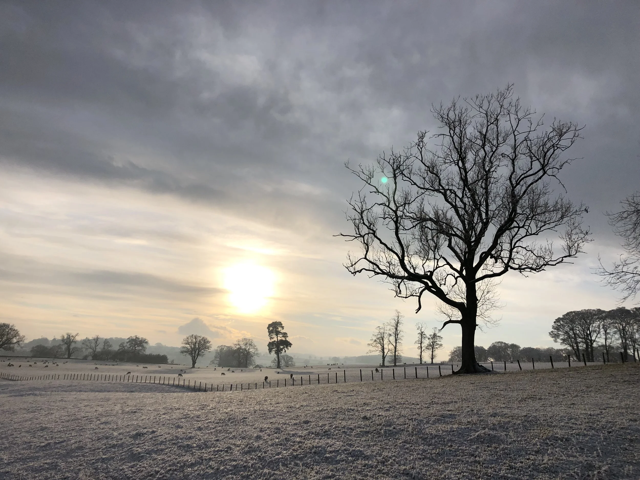
Growing up among the fells of the South Lakes, there was no particular love lost on me for the distant Eden, inoculated as I was to the charms of the lowland bucolic by the awe of the upland sublime. But in the autumn of 2022, thanks to the dual purposes of wanting to move back to Cumbria from Scotland, but needing to be a close enough to the West Coast mainline railway for Rose’s work, I found myself contemplating the possibility of a short-term future spent in this unfamiliar stretch of homeland. I drew vague lines on the map to illustrate the boundary of my interest, deigning to consider its outer reaches and upper edges, but rejecting outright the interior: too low, too flat, no good for fell running. It’s hard to run up big hills where there are no big hills.
But inevitably, after a long and fruitless search, right there, exactly in the place I said I did not want to be, we found a house that suited us; with a huge garden, big old trees, a workshop and perfectly dark, quiet night skies. It felt like an opportunity too enticing to ignore for the sake of running. So I accepted my fate, resigned myself to driving to the fells for hill running, and resolved to explore the joys and challenges of running among the rolling fields and sandy riverbanks outside my door.
Almost immediately after moving in, my mind leapt to the obvious running challenge of this big green trough: to trace its namesake river – the tenth longest in England – either from source to sea, or sea to source. Without more than a few seconds’ judicious googling, it was obvious to me how I should do it. The ‘Eden Way’ long-distance route (as contrived by Charlie Emett) passed by the new house – not just near, but so close that to step off it would be to step into our front garden – and passed it almost perfectly at a one-third or two-thirds distance, depending on which direction I went. It was with delight that I also noticed that thanks to our proximity to a station along the Carlisle-Settle railway line, and equivalent stations near the start and the end of the Way, I would not only be able to do it in three equal sections while sleeping in my own bed each night, but I could do so entirely via public transport, neither disturbing my partner for lifts, nor disturbing the environment by pumping out car exhaust fumes.
The river, the train line and the path spiral lazily down the valley for more than 80 miles, in a pleasing triple helix, criss-crossing each other time and again as they head north, past farms and villages, and straight past my home. This simply had to be done.
Inevitably, in the two days before my attempt, every small twinge and old pain I ever remember having in my legs and feet decided to rear their heads, whispering to me ‘don’t do it’, ‘you shouldn’t’ and occasionally, ‘you can’t’. But I knew full well that ready-made escape routes were dotted along the journey in the form of the Carlisle-Settle train stations, so I resolved to just get started, and see how it went. I chose to do the route ‘in reverse’ from what the guide book (written by Stuart Greig) suggested, because I thought it would be better to arrive at my house two thirds done, when it would doubtless offer more comfort than at the end of the first day. Also, I would be running ‘downhill’. I planned to stop each day for a proper lunch at a café on route, and end each day on the sofa with my feet up in front of the fire. This was not going to be a hardcore mountain adventure, this was going to be just a very long stroll.
__________
On the first Sunday of February I got up at 7:30, and had some porridge. The first train of the day from Lazonby didn’t depart until around 10, so I pottered around for a while getting ready, and then cycled my way nonchalantly down to the village. The morning was cold and crisp, and 20 minutes on the bike wasn’t enough time to get warm, so I stood shivering on the platform for a while, trying to ignore my sore knee, and then – finding that the sole of my right trainer was completely coming away from the upper – tried to ignore that too. I already knew these fairly minimal fell running shoes were the wrong thing to wear for this, even putting aside their imminent disintegration, but they were what I had, so they were what I used.
Once on the train, I stared out of the window and saw the next two days of running whizz by in less than an hour. The first lambs of the year were already up and running about in the frost. The ticket inspector came past. ‘Eee gum!’ he intoned with broad Yorkshire incredulity as he scanned my ticket, ‘ye must be cold in ‘em shorts lad!’. I was.
At Langwathby, the train was halted so that a policeman could stride up and down its two carriages, casting his head left and right at every seat, looking for someone. The two men behind me gossiped that it was a soldier on the run from the training base at Warcop. I wondered what he might have done to warrant such a search. But after ten minutes – apparently no runaways having been found – we were allowed to move on, sliding out through fields, and fields, and more fields, and then up, up between the low brown fells of Mallerstang, until eventually we crossed the Dandry Mire viaduct and slid to a halt at Garsdale.
Striding out of the station at 10:45, I was on my way, though it would be another seven miles until I would touch the source of the river that was going to be my guiding force for the rest of the journey north. I passed beneath the viaduct, trotted past the pub, and walked a short way up the fellside to where ‘The High Way’ track traverses the east side of the dale, an easy run to start the day.
At Hell Gill bridge the beck cuts an impressively deep chasm into the limestone below, swirling and chucking this way and that, but narrowly enough that you are over it in just a few strides. I had briefly been running through a corner of Yorkshire since the pub, but here at the bridge I returned to Cumbria. The border between the two counties traces the beck up the fellside to the ridge, and I followed, up the climb to ‘Eden Springs’. Compared to what would follow over the next three days, this section was an anomaly – an hour or so of soggy, boggy fellside in true fell running tradition.
‘Eden Springs’ is nothing more than a small puddle in a peat grough, in an inconsequential dip between Hugh Seat and Gregory Band. Who Hugh and Gregory were, I don’t know. And who decided that that particular puddle was the one, rather than any of the half dozen other trickles rising nearby, I don’t know. But the map said this was where to go, so that’s where I went.
Having now properly commenced my source-to-sea, I sped up on the descent, feeling like a fell runner for the first (and last) time on the Way, and was back down to the bridge before long. A short way below the bridge, the beck takes a distinct sweep to the north, and without fanfare becomes known as the River Eden. Now I was really on my way.
An elderly couple out walking their dogs grinned at me as I trotted past, munching on a cheese sandwich.
‘Where are you going!?’ the woman yelled.
‘Appleby, I hope’, I replied, spraying breadcrumbs.
‘How lovely’, she said, her husband nodded vigorously, and they watched as I disappeared off down the lane.
Mallerstang is a quiet valley. Marginal farmland, cottages and barns, all hidden away from the world below. It was part of the expansion of the Yorkshire Dales National Park in 2016, to take in the northern part of the Howgills, Ravenstonedale and Ashby Scar, an area referred to as the ‘Westmorland Dales’. It feels somewhat Yorkshire in spirit, even if not in fact. The navigation was straightforward, as it would remain all journey; mostly public footpaths across farmers’ fields. I scanned constantly for little yellow arrows and mouldy wooden fingerposts, and passed over more stiles than I care to recall.
Half way down the valley I passed the ruins of Pendragon Castle (a bit of a let-down given the exciting name, if truth be told), then the ruins of Lammerside Castle a few kilometres later (castle is a stretch), before I was on the downward path to Kirkby Stephen. At Wharton Hall farm I had to pause for a moment to marvel at the biggest slurry pit I had ever seen: a veritable lake of cow shit, held back by gleaming new galvanised steel panels and beams. You shudder to think what would happen if it burst open, unleashing a tidal wave of animal sewage onto the buildings below. No-one gets out alive.
I slowed gratefully into Kirkby Stephen after 32 kilometres, non the worse for wear apart from a bit of a sore foot, and enjoyed a slice of orange and carrot cake and a coffee at The Mulberry Bush café, trying not to deposit too much mud onto their floors. The ‘Stephen’ in Kirkby Stephen is apparently not the name of some saint or farmer, but derived from the Old Norse description vest idun: west of the Eden. I can confirm that it is.
Within half an hour was back on the road, leaving town a whole hour ahead of my roughly pencilled out schedule. Thanks to the Eden Way’s strict (not to say slavish) adherence to public rights of way, and the shameful lack of any footpaths along the riverbank at this point, the route map directed me out along country lanes all the way to Soulby, and I didn’t see the river again for five miles, by which time it had mellowed from the bouncy upland beast that it was above Kirkby Stephen to the mellow plains watercourse it would remain for the rest of my journey. But I cantered along quite merrily, spurred on by sugar and caffeine, my sore foot miraculously cured by sitting down for half an hour. Although most ultra-runners will tell you it is best to keep up a consistent speed over long distances, I had been shifting gears from a slow walk to gentle trot to fast run and back again all day as the mood took me, and here I felt like I had the perfect combination of plentiful energy and a hard running surface to propel me at speed and make some real progress. Sometimes, in the full knowledge that another period of steady plodding isn’t far around the corner, you just have to make hay while the metabolic sun shines.
From Soulby it was back into fields again, but since Kirkby Stephen they had changed, from rough and scrubby marginal lands to perfectly rich green pasture – a veritable blanket of Microsoft Windows XP paddocks. The stone too had changed, from knobbly grey-white limestone to gritty deep-red sandstone, the characteristic building material of all the lower Eden villages.
I passed a row of 31 dead mowdys, neatly pegged to the fenceline by the mole catcher, as they like to do. I don’t know why. Even if moles are nothing but pests to you, why put their massacre on display, like so much gaudy velveteen jewellery on a barbed-wire thread? It’s not as though the other moles will come, and see, and give up their excavatory ways: ‘It’s no good lads, our fate’s hanging up there as clear as day if we keep this up, time to get out of the landscaping business’.
Warcop is known for the military training area that stretches up and over the fells from the village. Those 24,000 acres of fell, bizarrely, it is both designated as part of the North Pennines AONB (Area of Outstanding Natural Beauty), while also being one of the biggest live-firing ranges in the UK. Once 3% of the common grazing land in England, it was requisitioned by the Ministry of Defence in 1942, given the urgent prospect of the Nazi’s goose-stepping their way across Europe towards the channel. Most of the armoured formations that took part in the D-Day landings trained there. In 2003 the MoD bought the grazing rights from the commoners, given that tanks had a greater appetite for land than sheep, and it effectively ceased to be common land, though with mollifying promises made that the land would not be de-registered as such. It was deregistered in 2018.
I ran past the village, wondering if they caught the fella that the policeman on the train had been searching for, and if he really was from the military base. I never found out.
I paused for a moment to look at the bridge. Warcop Old Bridge is the oldest bridge on the Eden, built in the sixteenth century, and still going strong. It does look old, but then, all the rest do too. So after a minute or two, I carried on.
Just above Great Ormside I chanced upon a great view of the Pennines to my right, illuminated in beautiful bright pinks and oranges by the early sunset.
By now, I was feeling much more positive than I had been that morning about the prospects of not only finishing the day, but also finishing the entire thing. They were the wrong shoes, yes, but my feet felt ok. This was a long way for me, yes, but I was getting there, and not feeling too bad for it. Everything had gone more or less exactly according to plan. I hadn’t gotten lost, and although my legs were a little heavy after 45km, all the little sorenesses of earlier in the day had deadened themselves out, as those little things tend to do over the course of a very long run, and I felt ok. I was also optimistic about reaching Appleby before dark, which would make things easier.
I had barely seen another soul all day. At times it felt like I had the whole route to myself. Because I had picked an almost perfect weather window – mild, clear and calm – it barely crossed my mind that this was February, and I may well have actually had the whole route to myself.
I strode over the bridge by Appleby Castle with a satisfied air – briefly intertwined with the distinct whiff of smoke from the couple who had not-so-subtly parked up by the river to share a spliff – and endured a final few minutes of pavement-pounding up to the station, where the beckoning lights of the Midland Hotel tempted me in for a quick lager shandy before my train. A mere two stops later I was off, on my bike, cycling home, and had my feet up by the fire with a homecooked dinner before I even knew what was happening.
In true ‘stage race’ style, I started and stopped the clock at Garsdale and Appleby stations, but let it run through all breaks during the day, which gave me a nice steady time of 50.5km in 6hours 45 minutes for the first day.
__________
The second day was another cold start, but my legs felt pretty good on the bike, and I cruised down to the station without complaint. The train was half an hour delayed, but knowing that this was the shortest day of the three, and I would have no cut-offs to chase, because I was literally running all the way home, took all the pressure off.
Despite some locals perhaps wishing it were not the case, Appleby is without much doubt most famous for its horse fair. For four days in the first week of June (and for a good while in the lead up to it), some tens of thousands of Travellers and curious observers descend upon the town in one of the largest Gypsy fairs in Europe. The riding of horses into the river to be washed is a distinctive sight, and the trundling of traditional wooden wagons along the A66 is undoubtedly as charming as it is frustrating to modern sensibilities. But now, at the opposite end of the year, all was quiet as I crossed the bridge and trudged slowly out of town, along the lane to Colby, and then to Bolton.
At Bolton began a long and pleasant stretch of the Way through riverside fields all the way to Temple Sowerby. The river by now had taken on a wide, languorous character, as though confident and unabashed in the knowledge that it was the largest river for miles around. I kept a keen eye out for otters and kingfishers, but all I saw were sheep and cows. Oh well.
I was moving slower than the first day, but that was ok. At around the 66 kilometre mark (pleasingly just after the route passed beneath the concrete bridge of the A66) I stopped at the sculpture ‘Red River’, by Victoria Brailsford. It was one of the many ‘Eden Benchmarks’ along the route, a series of sculptures doubling up as benches. They were welcome little intrusions of public art, slightly greened over by the preceding couple of decades, though none really struck me as things to go out of your way to see. This bench though, I had decided in my mind (without much consultation to the actual map) was the half way point of the entire route. It now seemed quite plausible that I would be able to finish in the manner I intended, and I was pleased.
Overall, this run reminded me of the importance of chunking big goals down into little manageable bits. I split each day into halves, and then into halves of halves, and halves again, and I thought of them that way – not one eighth of the way done, but half way to the next, and again, and again, until before I knew it, I was closer to the end than the start, and it was as psychologically as all-downhill-from-here as the gradient had made it topographically all along. On this score, it was also helpful to have my maps printed out on lots of sperate A4 sheets, at a 1:25,000 scale. I was using the definitive Way map as provided by Pocket Routes, and it was a surprisingly useful tactic to have the whole thing divided up into separate pieces of paper, not just for the ease of holding and using them, but also for the motivational benefit of going through four to five maps a day, and passing across them quickly enough to feel like real progress was being made. Although in my opinion – as all good fell-runners will agree – Harvey maps are the best mountain maps around, for this particular route the Ordinance Survey wasn’t just the only option available, but had an edge over a Harvey in any case, because contour distinctiveness was of negligible importance, while the pale OS background helped to keep field boundaries clear, and the granularity of individual buildings was useful to figure out exactly which way through the village my path went.
After a little more riverbank, and a short patch of woodland, I faced a long stretch on the road, from Culgaith to Little Salkeld. I knew it well, having driven it many times, but that did not stop it from being a thankless foot-slapping lope of five miles on the litter strewn verge, the occasional car whipping by, mollified only slightly by a view across to the northern fells of the Lakes poking out on the horizon. Fortunately I had planned to split this tarmac trudgery in half with the insertion of lunch-stop at The Shepherd’s Inn at Langwathby, and their ‘Highland Fries’ (chips with Haggis), and chocolate cheesecake went down a treat.
Perhaps too much of a treat, as it turned out, as I then spent half an hour lying on their bench in the sunshine to digest. Eventually I managed to get myself back up and off, and down the road to Little Salkeld.
This was not the first time I had walked down this lane. When I was 17, fresh from finishing secondary school, I embarked on a three week tour of the county, alone except for odd days here and there joined by my sister, brother and girlfriend. I travelled aimlessly around this way and that across Cumbria, sometime walking, sometimes on buses or trains, and popped up in some strange places for a 17 year old to choose to be on his summer holiday. I suppose I felt that, having grown up in Cumbria, I ought to know more about it. Despite it being only an hour away from home I had almost never been to the Eden valley, so when I stepped off the train in Langwathby, it felt like a far off place. A farmer let me camp in their garden at Little Salkeld, and in the evening I walked up to have a look at Long Meg and Her Daughters stone circle. An impressive ring of 59 megaliths, it is one of the widest stone circles in the country, built for who-knows-what reason four or five thousand years ago, and carrying with it various myths of witches and wizards and giants and ghosts. There were a couple of caravans parked up next to it, with their retiree owners sitting outside enjoying an al fresco dinner to compliment their palaeolithic history appreciation. The next day I had walked along the road as far as Glassonby, before hitching a lift with a van over Hartside pass to Alston with a travelling vet. He was in a fractious mood, on his way to rescue a dog that had gotten itself up a spiral staircase but was refusing to be gotten down again.
‘And I can’t sedate the damn thing because it’s so heavy we’ll never get it down without dropping it!’.
But back to the present. I didn’t feel like detouring to Long Meg this time, as it was a few minutes out of my way. So I stayed on-route, and jogged down to the track by the railway to make my way through Cave Wood, only to be greeted with a large and adamant ‘Foothpath Closed’ sign zip-tied to the gate. I knew this to be the case, as I had walked to the caves from the other side of the wood only two days before, where a similar sign tried fruitlessly to ward of the locals, who mostly just ignored it. But now the farmer was stood in his yard next to me with a screaming grinder, sparks flying from whatever machinery he was whittling away at, so I hurried by as quickly as my legs would carry me, lest he turn around and take umbridge at my blithe ignorance of the sign. Another few hundred yards down the track, a Network Rail employee was lounging in his truck, and once again I sped up to a near sprint so I could get past and off into the woods before he even had time to wind the window down and shout after me. It’s quite impressive how nippy on your toes you can get when the moment calls for it, even after 48 miles.
And so, to Lacy’s caves. Although these sandstone excavations into a cliff by the riverbank seem somehow ancient and mysterious, they were in fact created by a member of the local gentry – Colonel Lacy – in the 18th century, who ordered them made to tickle the fancy of his dinner guests by serving them food and wine in a delightfully romantic candle-lit cave, in an era where classical cultures and ancient artefacts where all the rage. The same fella once tried to blow up Long Meg and Her Duaghters, but (so the story goes) the workmen he sent up to do the deed were suddenly ensconced in a raging storm, and they refused to carry it out, sensibly deciding that the impending demolition had angered whatever gods or demons held sway over the ancient site.
From here I was on the home stretch, and I relaxed, trotting easily along the bank. The sun was out, the path was known, and I would have plenty of time to get plenty of rest before the final day tomorrow. I made a detour over the Lazonby bridge to see the ‘Benchmark’ sculpture, which – despite driving past hundreds of times – I had never bothered to have a look at. A little further on, I did the same at Kirkoswald clock tower. It’s funny that when stopping is as easy as pushing a brake pedal, we can’t seem to find the time, but when it involves a five minute detour on a six hour walk, there’s suddenly plenty of time to spare.
Out of ‘KO’ (as all good Eden valley residents call it), I was on the route of one of my most regular runs from home, and before I knew it I could see the steep roof of my little red house. Here in the lower Eden, every village is built of that distinctive red sandstone, quite soft but readily available. The fact that my own house is built of it is unsurprising, but a pleasing enmeshment to me with my home-for-now.
It was snowdrop season, and every woodland I had passed throughout the run had greeted me with a scattering of little white droplets here and there to break up the brown mouldery winteriness, but nowhere did I see more than now, as I closed the field gate and stepped into own back garden. I paused to admire them blanketing the ground beneath the oak and beech trees, then I went inside and spent the evening stretching, reading and eating.
The stage race timer read 36.5km in 5 hours for the day, for a total so far of 87km in 11:45. Interestingly this was very close to my previous benchmark of distance (a 50 mile race) of 81km in 11:14, although there were no café or pub stops, nor a sixteen hour pause in the middle, on that occasion (mores the pity).
__________
On the morning of the third day, I swung my legs out of bed cautiously, knowing that the cumulative impacts of the previous two days may have made them very sore, but I was pleased to find things still functional. After five minutes of pottering around making tea, I was sure that I could set off, and confident that I would reach the end one way or another.
Perhaps it helped that the first few kilometres were very familiar, along the road to Coombs wood and through the trees to Armathwaite. A fine mizzle dampened me down for an hour or so before clearing, but this turned out to be the only ‘bad’ weather of the entire three days, which practically qualifies as a miracle in Cumbrian terms.
After the village I passed by one of the tall viaducts of the Settle-Carlisle line and then enjoyed a good stretch of nice running along the riverbank through native woodlands, next to sandy cliffs. On my map I had marked off that here was the ¾ mark of the entire Way, and this gave me a little boost, although not much was needed. Things were just steady away.
Over the next hour, the woodland slowly deteriorated into a soggy marshy mess, and I began to get the sense that I was drawing closer to an area of more people and more buildings: marginal land, a little less pleasant, a little more grim.
Three problems became clear to me on this run, First, the amount of litter, both along roadsides, in hedgerows, and hanging along the river banks, as much from agriculture as from careless people. Second, the failure of those who have trees planted on their land to clear away plastic sheaths once the trees have outgrown them. And third, the privatisation of all fishing along almost the entire length of river. I don’t have solutions for any of the three, but all made me cross from time to time as I passed by yet another plastic bag, another plastic sheath, another ‘no entry except for well-off people who can afford our outrageously expensive licence’ sign.
The map name ‘Fishgarth Holm’ draw my attention as I passed, and I added it to the mental list of interesting names that I had passed on route, which included: Hanging Lund, Ford Angerholme, Enterber, Sweetmilk Bridge, Oglebird Scar, Throstle Hall Brow, Brocklewath and Demesne.
Wetheral provided three distractions. First, St. Constantine’s cells, another set of sandstone cliff caves, which supposedly housed a Scottish hermit in the 6th century. Second, a striking neoclassical folly scene – a ‘mannorist cascade’ as the interpretive sign put it – cut into the rock on the opposite bank of the river from the path (à la Colonel Lacy), inspired by owners ‘Grand Tour’ of Europe popular with the aristocracy of the 18th century. And third, barely a few hundred strides further on, the Wetheral viaduct, apparently (very briefly) the largest railway bridge in the world when it was completed in 1834. It is an endless source of fascination that on this small island, you cannot move without tripping over some significant piece of the story of human habitation. Our temperate climate and green land has always been attractive to people, and the riches and infrastructure that we as a species have spawned lie over it in countless layers of history; in the Eden as much as anywhere.
Immediately following this diverting series of landmarks came easily the dullest section of the entire run, between Wetheral and Carlisle. Villages, lanes, industrial estates and flat fields, and the city outskirts. Forgettable and drab. By far the most exciting thing was passing over the M6, that great artery of national life slicing remorselessly through an otherwise sleepy corner of England. I wonder if in a few hundred years there will be an interpretive sign here to help visitors understand the significance of this endless river of tarmac. For the people of the time, driving vehicles with internal combustion engines called ‘cars’, was central to their way of life…
I made good use in this stretch of the ultra-runners shuffle, which was convenient, as the slow pace allowed me to scan the ground for landmines, little dog shits left there by big human shits who didn’t give any shits about other people wanting to use the path.
Carlisle itself is not particularly to my taste, though I don’t exactly know why. It has never wronged me in any way. It has a great deal of interesting history, from the Romans onward, thanks in part to its position as gateway between Scotland and England. Maybe it is because I never had much to do with it. Although it is the biggest town in Cumbria, it was about as far away to drive from where I grew up as it was possible to be in the county, so we never really went there, and I think the same could be said for most people in the Lakes.
My plan was to stop at The Old Engine House café. It was 10 minutes or so off route, but I had heard it was good, so I did the walk anyway. It was good. On the walls I was pleasantly surprised to recognise the artwork of my friend’s father, Carlisle cobble squares glowing merrily under his brush-stroked streetlights. Outside the café window, it just sagged indifferently under a grey sky. Despite looking forward to my café pit-stop all morning, I didn’t linger long. After spending so many hours moving forward, thinking about the next milestone, the mind and body just wants to keep getting where you are going. And I was 90% there now. It was just a case of holding my nerve for a little while longer, not breaking my ankle or falling in the river, and I would be done.
On that tour round Cumbria I did aged 17, I got to Rockcliffe, but I didn’t go any further. I don’t know why. Having bothered to walk from Carlisle to the village, I seemingly failed to notice that the mouth of the estuary was a mere 10 minutes further along the river, and might be worth a look. Or perhaps I did notice, and just chose not to go. You make strange decisions when you’re travelling alone at 17. In some ways, I thought, as I trotted along the grass, the reason I was here doing this by myself was the same reason I had done that trip by myself over a decade before. It’s easy to agree in conversation with friends ‘we should do this’, but coordinating and prioritising and scheduling becomes a mess, and it’s usually easier to just not get it done. So sometimes you just have to decide yourself to get out thew door, and go and do what it is that you want to do.
From Rockcliffe, I could taste the finish line, and as soon as I got to the Demensne Marsh I picked up the pace to a fast run, then a very fast run, gleefully leaping little rivulets and dead seagulls, until I came to a holt at the edge of the sea. A sign said ‘go no further’. This was it. The river joined the Esk in the wider brown expanse of the Solway Firth, and was the Eden no more.
It didn’t look very exciting. I gave myself a pat on the back, took a picture, and turned around for the long slow walk back to Rockcliffe, then ASDA, and thence the bus to the train station, the train to Lazonby, and the bike ride home. My feet moaned at me the whole way for subjecting them to that last bit of fast running, but I told them to shut up, and made it home it one piece.
__________
I did not use a GPS watch, but careful tracing of the map afterwards showed that, on all the ‘official’ route, plus my detours, and the walk back to Carlisle at the end, I covered 141 kilometres/ 88 miles (with just 1395m/ 4500ft of ascent) in about 19 hours (all café breaks included!). I have never in my life run so many flat miles, and to be honest I would be willing to never to do so again. I am a fell runner first, and a distance runner second.
It would be a lie for me to suggest that I have fallen in love with the Eden. It is still not my home home, and I doubt it ever will be. But I feel better connected to the place that I live in after running through it for a few days, and that made it worthwhile. We are not disembodied souls, existing wherever our minds take us, we are creatures of the land, and the places where we are matter to us, whether we want them too or not.
In all honesty, I would not in good conscience recommend the route to people from elsewhere, as a destination adventure. But for people who live along the Way? Yes, I would. For runners who live near the half way, third-lengths or quarter-lengths stations (Kirkby Stephen, Appleby, Langwathby, Lazonby or Carlisle), who can do a three or four day ‘stage’ version of it, I would thoroughly recommend it, if only to see where it is that your river came from, and where it goes. It is a way to see the things that make the Eden valley what it is.
If nothing else, I believe everyone should do a big (whatever feels ‘big’ to them) adventure from their front door. Unlike expeditions that take place in some far off land, these feel somehow more integrated and relevant to our own lived experience. The juxtaposition of the big things we can do as humans, with the reality that we are still just small, transient lives, living in places for a time. You get to feel like Bilbo, setting out from Hobbiton, or Pigling Bland, venturing forth with his belongings in a handkerchief on a stick, but you get to come home again after, safe and well, and a little bolder for next time.
__________
Bobby Gard-Storry
Cumbria, 2023